

written by: Lucía García-Duarte and Giulia Carella
Wildfires can be detrimental to urban and rural areas, causing impacts in the form of injury, death and property loss. In fact, recent studies (here and here) have shown a dramatic increase in global wildfire activity as a result of increasing temperatures, drought and fuel aridity among others, leading to warmer springs, longer summer dry seasons and drier vegetation.
In this context, developing an index to evaluate the potential risk of wildfire ignition is of great importance in several decision-making processes involving public administrations, insurance companies or real estate/investment companies. For instance, a Wildfire Risk Index could be used:
- By government agencies to develop wildfire suppression plans, direct resources to higher risk areas, and aid in emitting wildfire alerts when needed
- By local landscape managers to prioritize and allocate investments to treat wildland fuels and identify areas with a high estimated loss
- By insurance businesses to provide affordable coverage, mitigate risks, and manage their losses, which also gives them a competitive advantage by offering wildfire insurance while others choose not to
- By power and utilities companies to design contingency plans that guarantee energy supply during disaster recovery to critical facilities and vulnerable neighbors
Measuring Wildfire Risk with Weather Source & CARTO
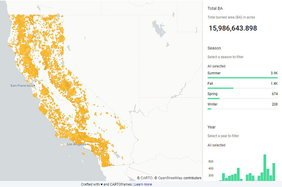
In this blogpost, in partnership with Weather Source, we examined the fires occurring in the state of California for the 2001-2020 period with the aim of determining a spatial Wildfire Risk Index (WRI) that allows decision makers to assess the risk of potential fire occurrences in a certain area. The following map shows the distribution of fires in the California region by year and season, with each dot representing a fire with size proportional to its burned area (BA).
read more…
(reposted with permission from CARTO)